Nine Years of Storm Photography
Welcome to my photography collection! I have been photographing storms since 2017, and have photographed
many of the Midwest's biggest severe weather events over the past several years. This page is a collection
of my favorite shots and recent stories.
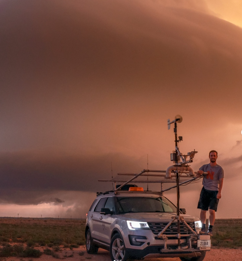
As a first-year research assistant, I served as a support meteorologist for the month-long TORUS-LItE field campaign in summer
2023. TORUS-LItE was a multi-institutional field campaign that deployed mobile radars, UAS, and other instruments to study
supercells. I assisted with weather briefings and mobile mesonet operations.
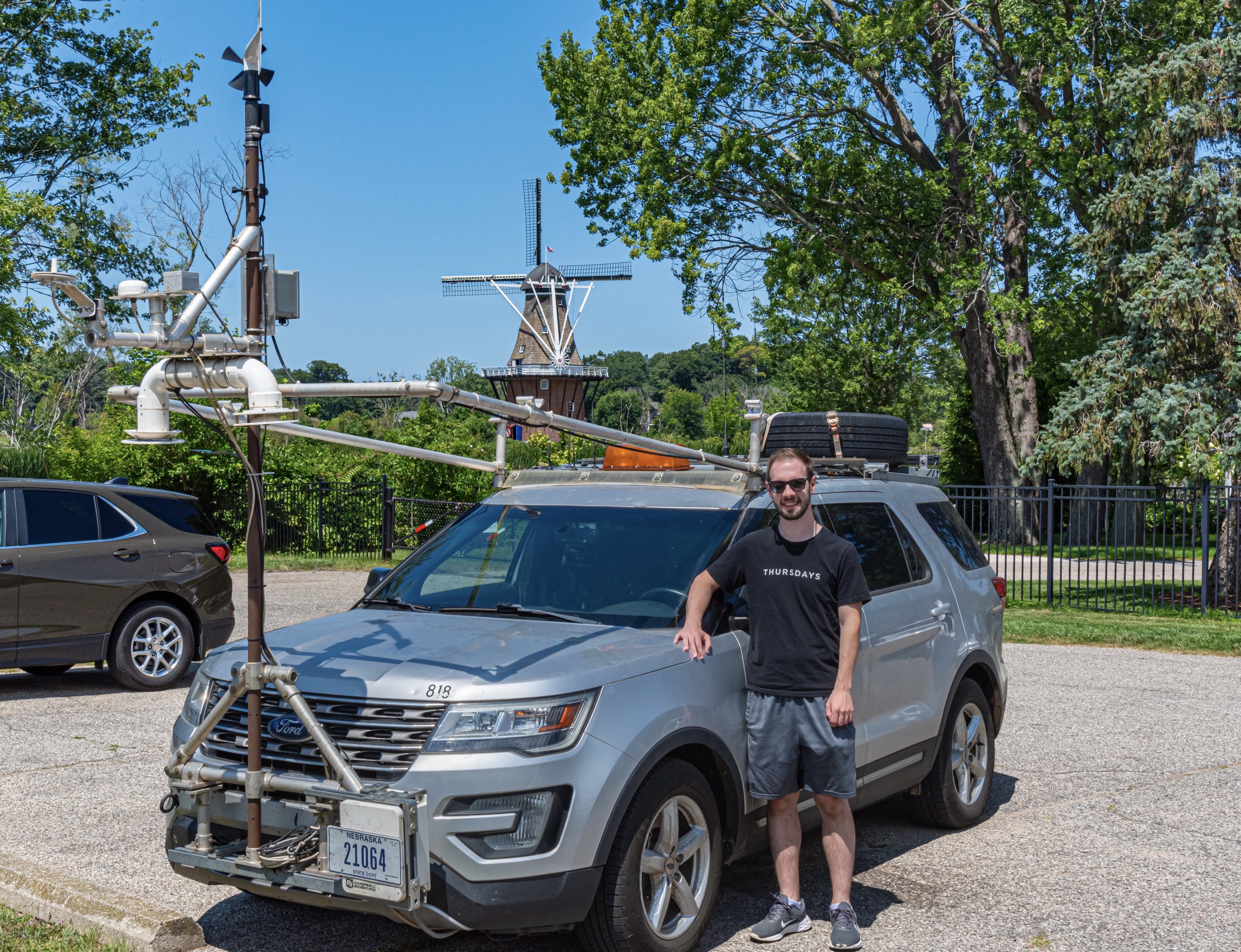
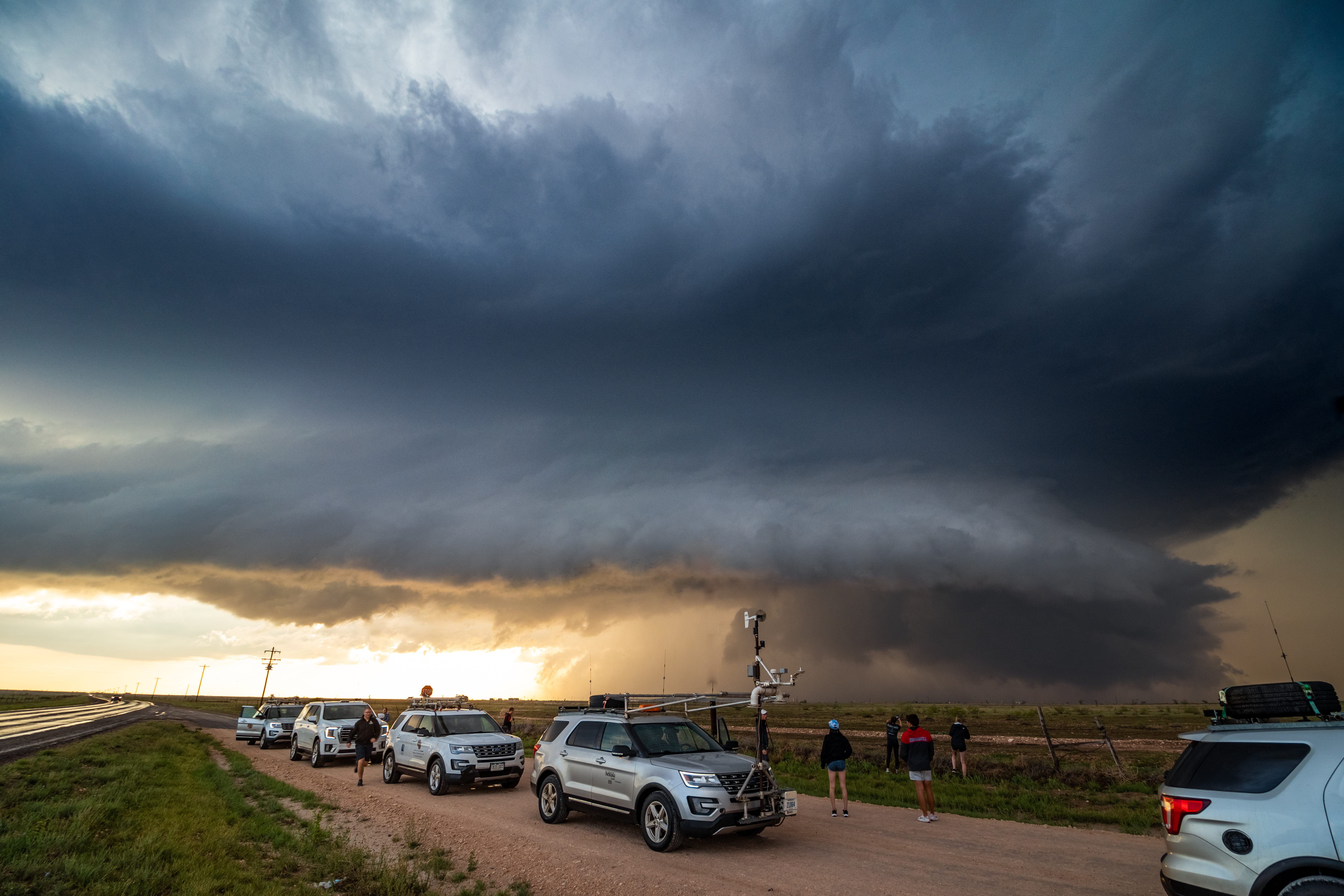
MITTEN-CI aimed to study the interaction of lake breeze boundaries in western Michigan with conditionally favorable deep
convective environments. I served as the lead meteorologist for two weeks of the month-long MITTEN-CI campaign duration.
This involved preparing weather briefings, coordinating with project PIs, and managing daily mobile mesonet operations.
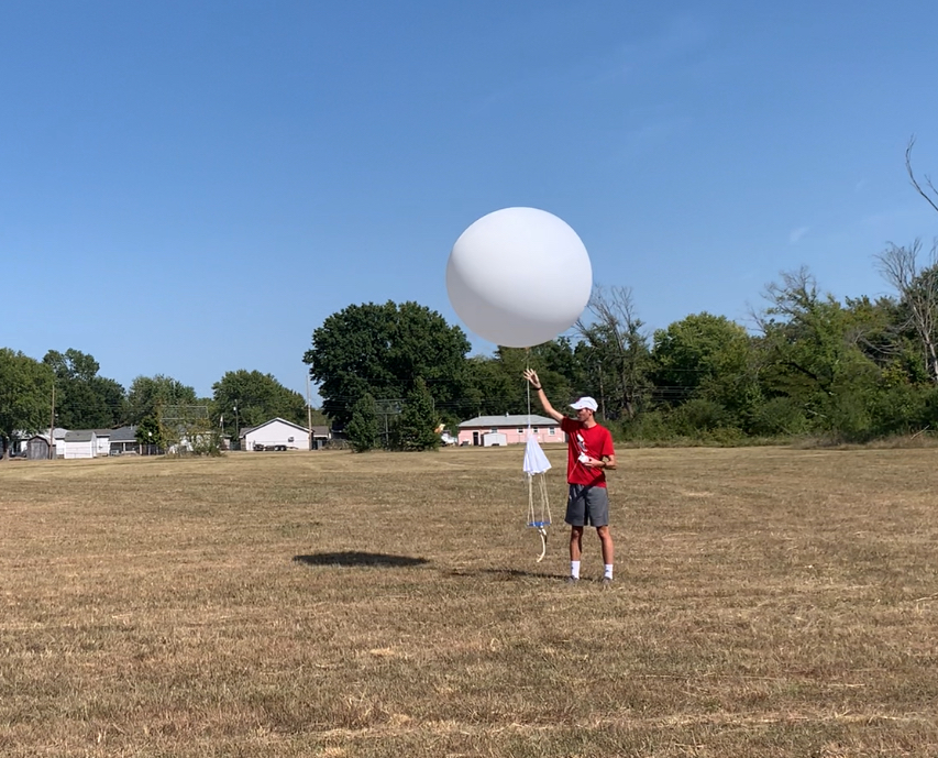
SCALES-UHI took place in Tulsa, Oklahoma, during the first week of September 2024. It primarily utilized UAS from a number of
universities to study the urban heat island effect in Tulsa. As a lead meteorologist, I oversaw site setup, hourly UAS profiling,
and periodic weather balloon launches.
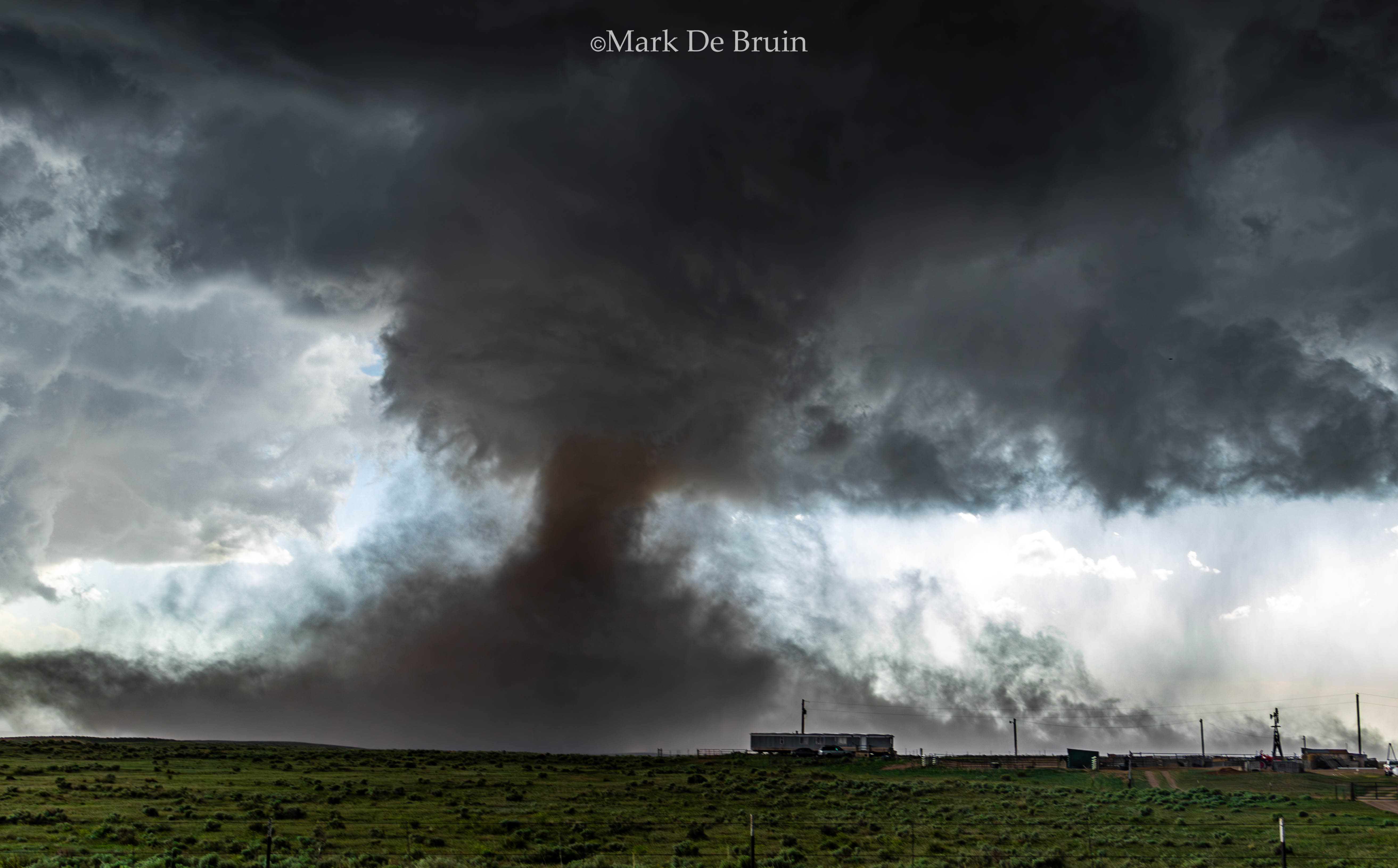
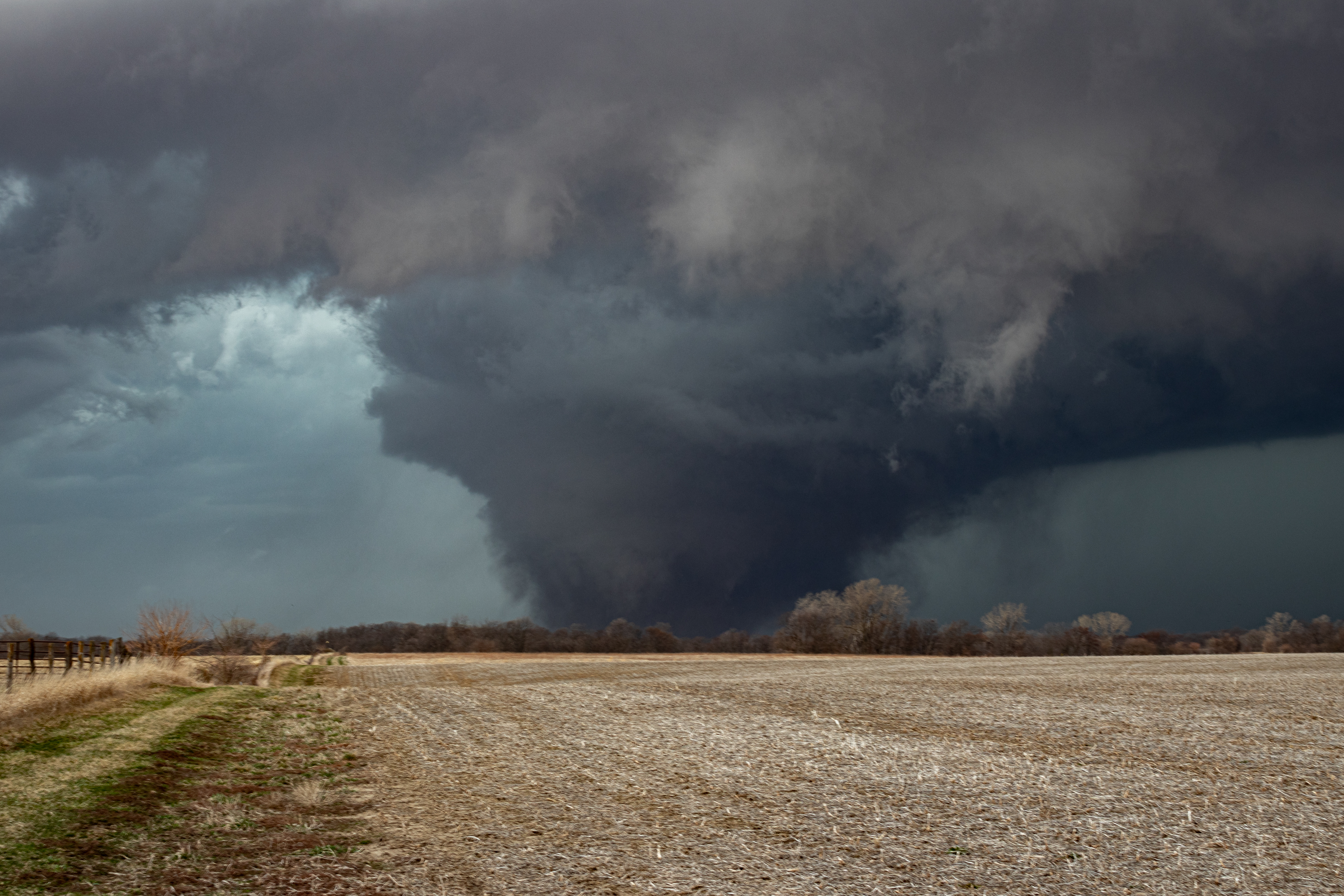
Multiple dusty tornadoes spawned beneath a powerful supercell as it seemed to ingest vorticity off of a quasi-
stationary dryline. The strongest tornado intensified from barely dust devil status gradually to a long-lived
EF-2 tornado.
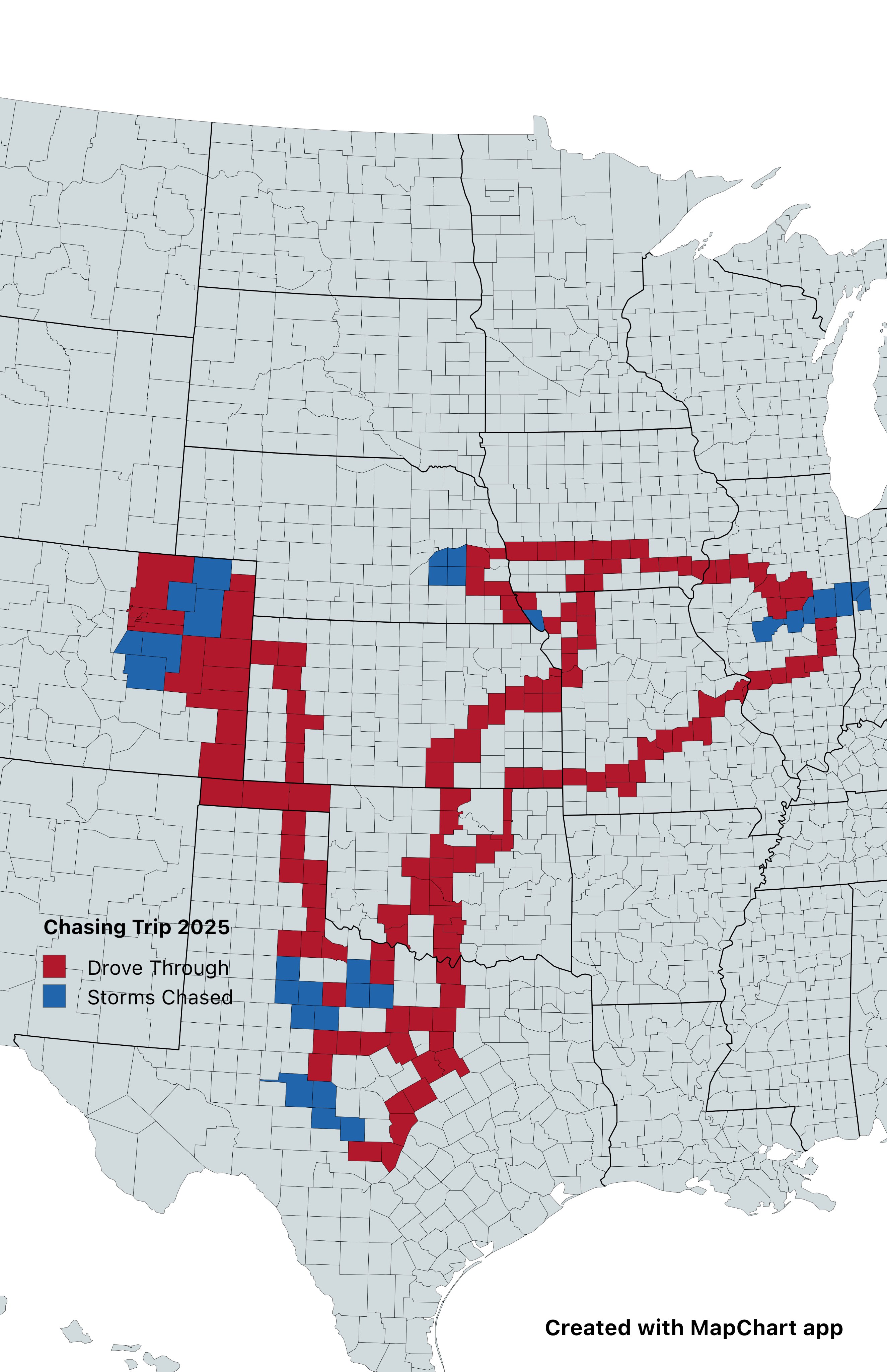
Beginning in Iowa, over 5000 miles were covered across 10 states over the course of 9 days.
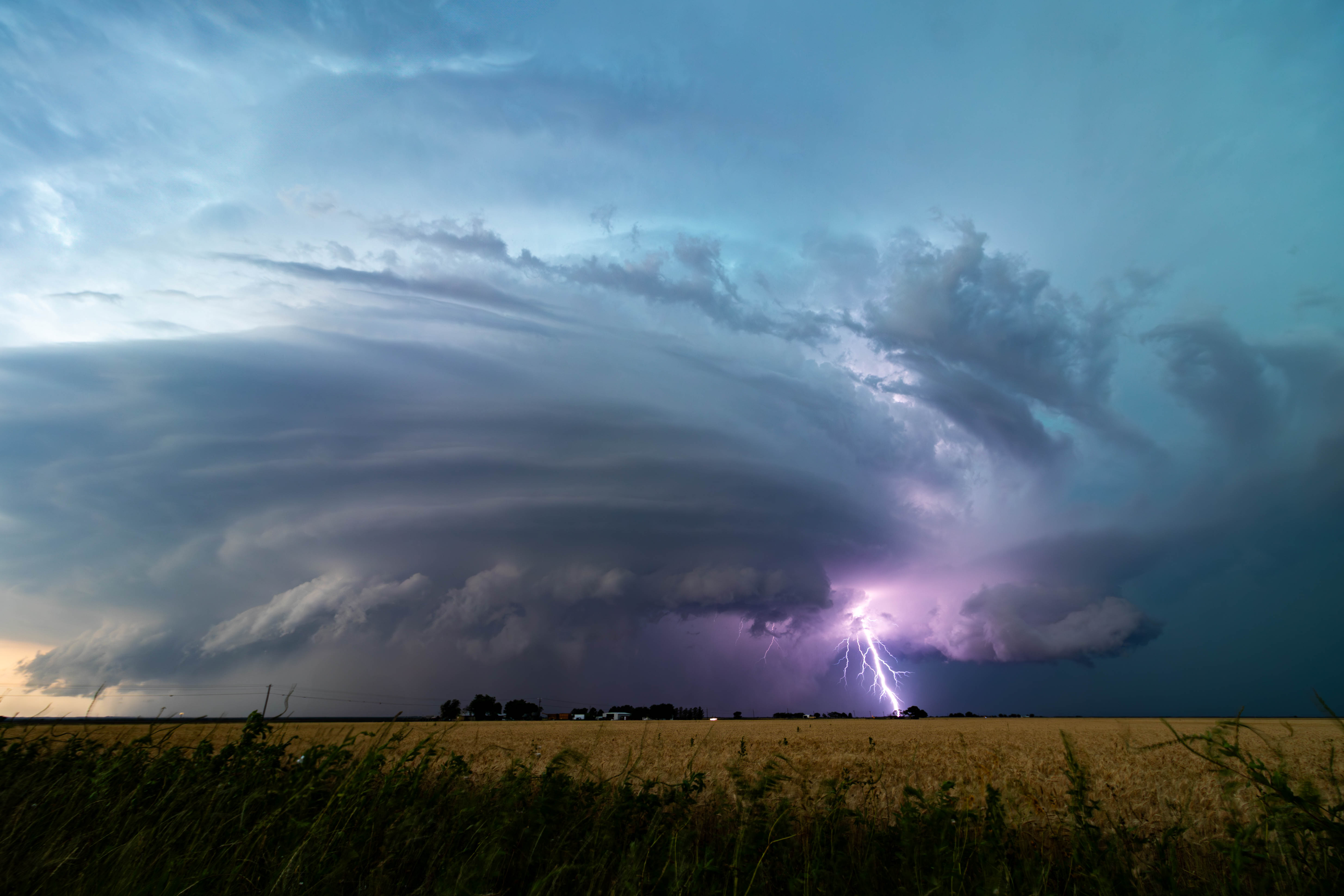
Weak upper level shear, strong low-level shear, and strong instability along an outflow boundary combined to
support a discrete supercell with a strong RFD and rapidly evolving mesocyclone. Each time the storm seemed to
be finished, a new cycle would build a full mesocyclone in minutes.
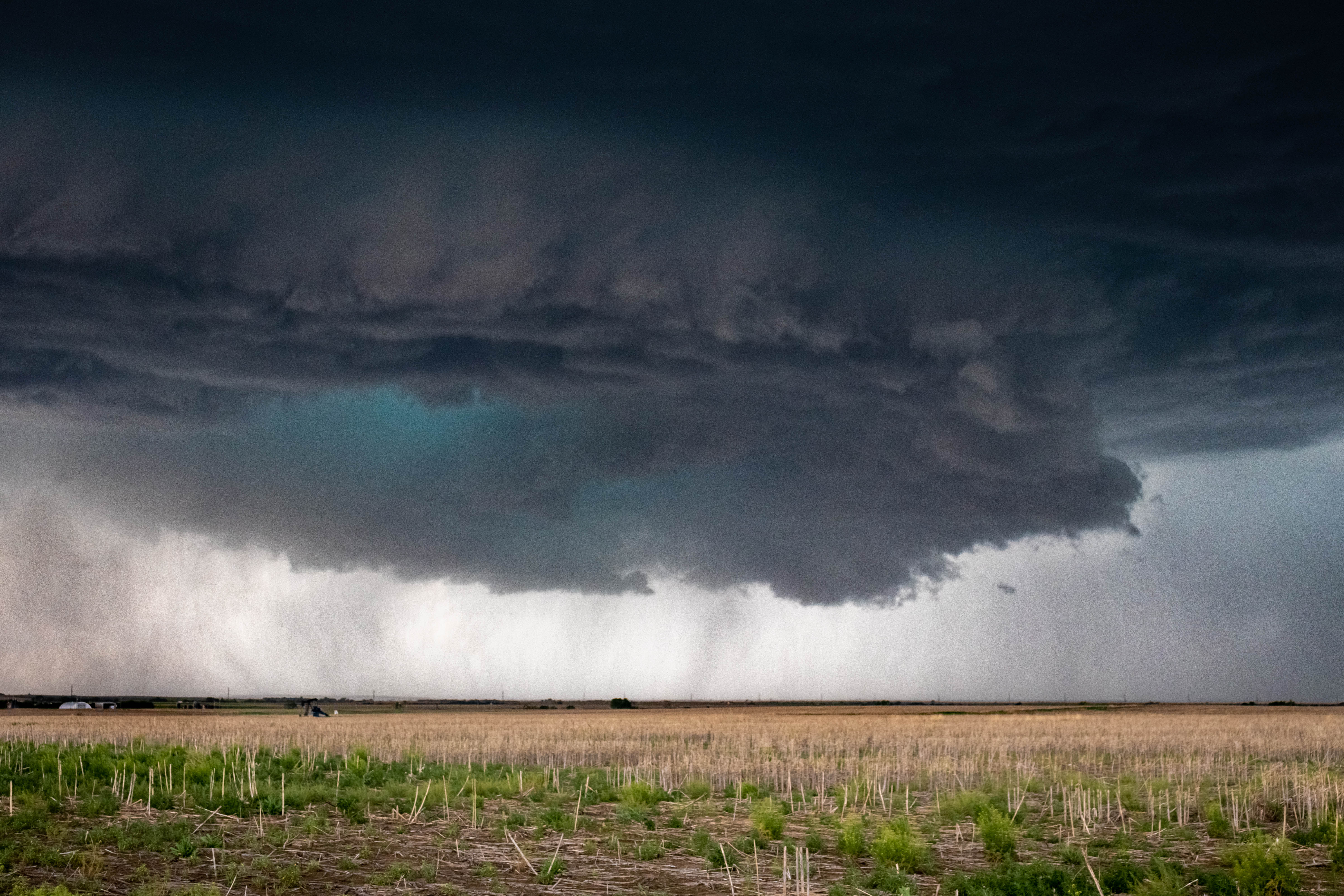
Ogallala, Nebraska - 23 May 2024
A slow moving cold front and streamwise hodographs resulted in multiple photogenic supercells that "unzipped"
along the front throughout the evening, producing tornadoes with each new storm.
Harlan, Iowa - 26 April 2024
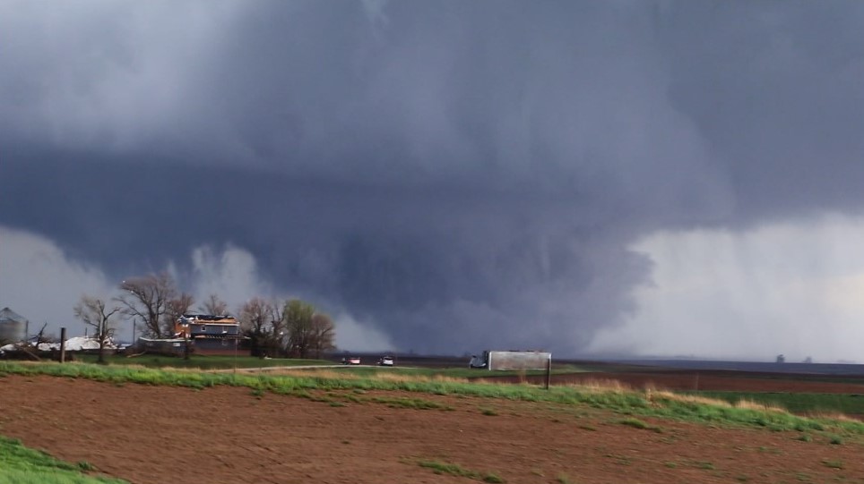
One of the region's largest tornado outbreaks produced this mile-wide EF-3 as well a handful of tornadoes near
Lincoln, Nebraska.
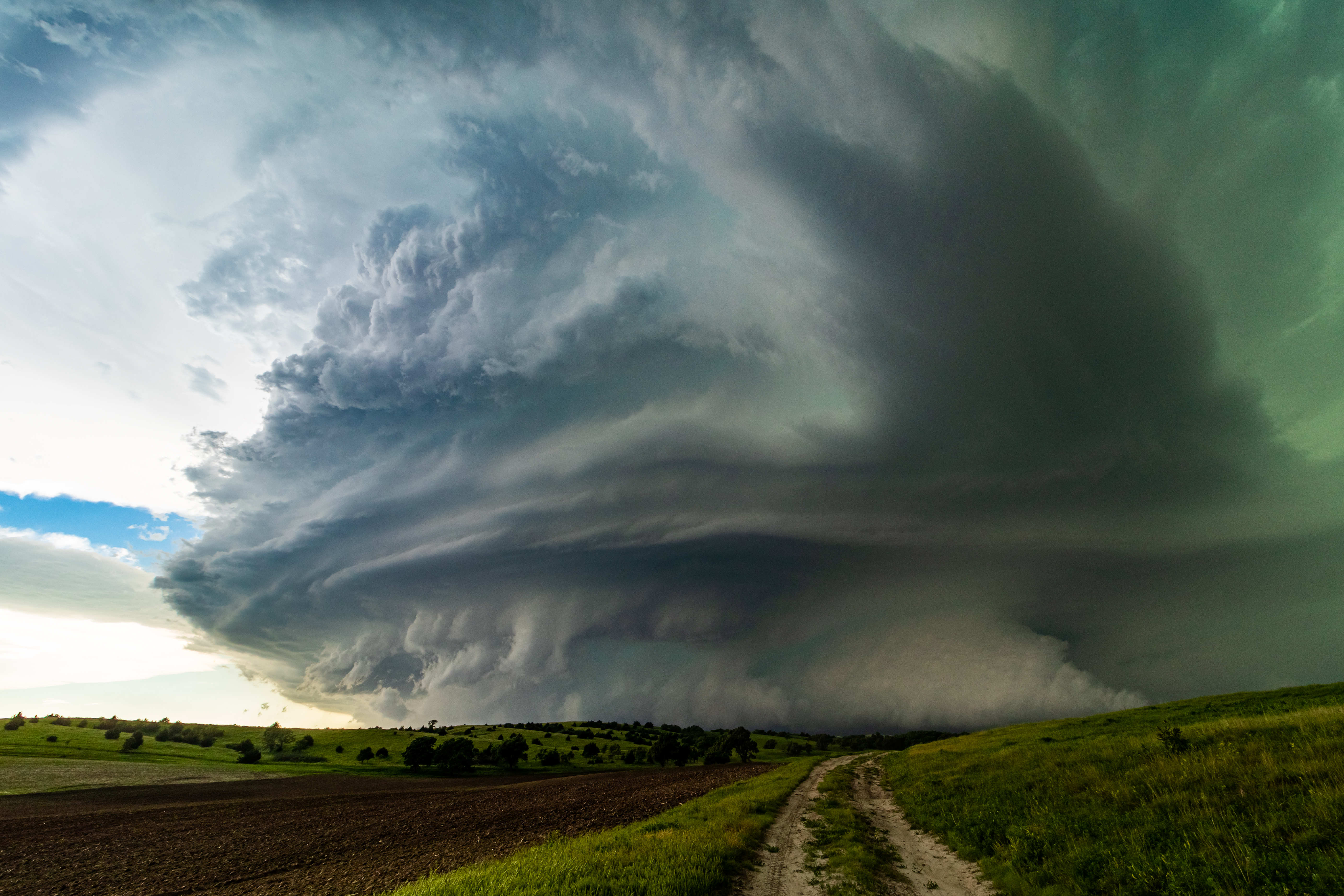
Ansley, Nebraska - 7 June 2024
A long discrete supercell twisted across the Nebraska Sandhills for at least 6 hours, producing mainly large
hail. I captured it with timelapse and a wide angle lens at its most photogenic moment as the mesocyclone
filled the sky.
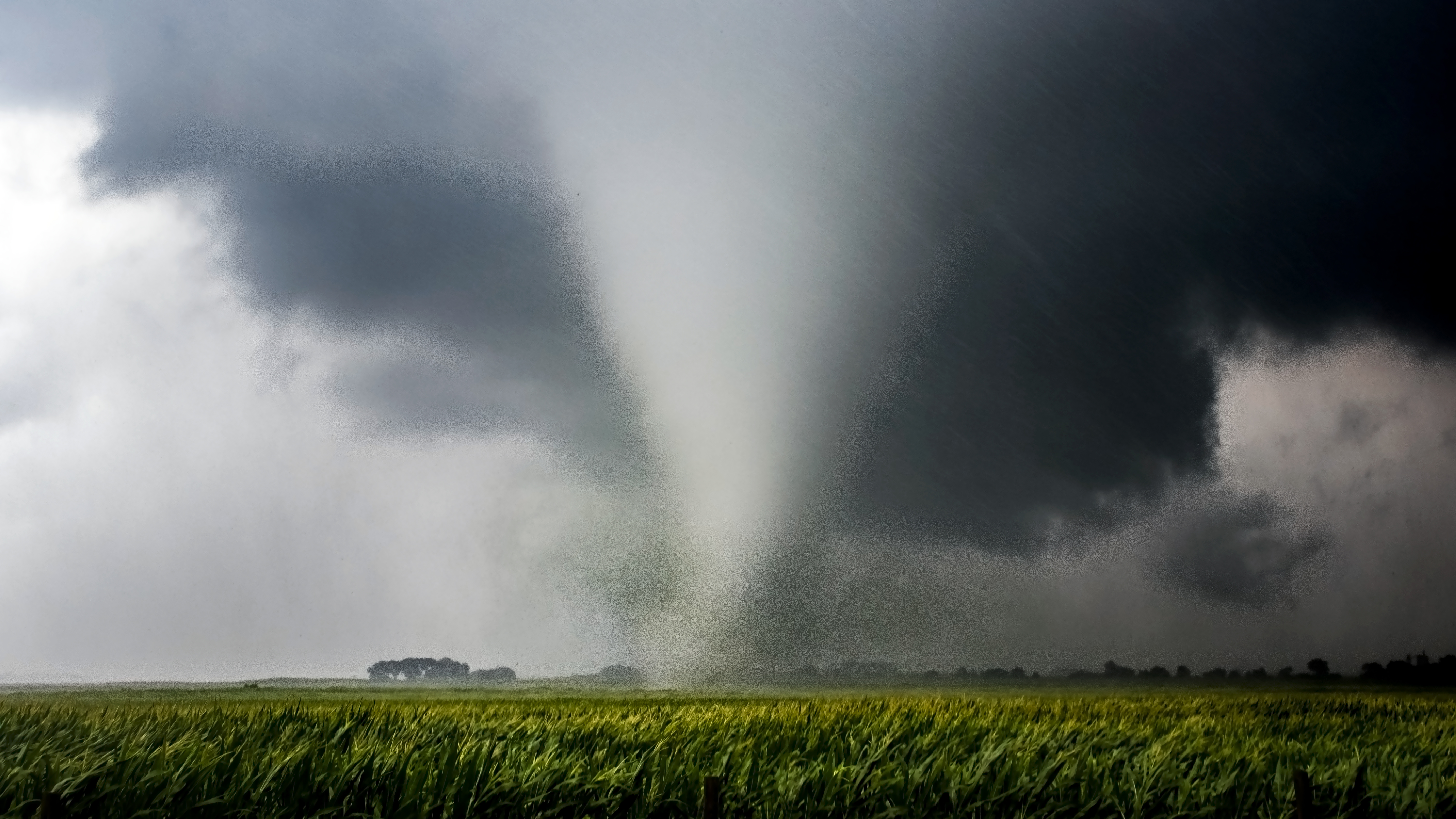
Keota, Iowa - 31 March 2023
A compact and ill-timed trough set the stage for a widespread tornado outbreak across the Central US. This tornado was
the strongest of over a hundred tornadoes, rated EF-4.
Jewell, Iowa - 14 July 2021
A morning MCS left behind a NW-SE oriented outflow boundary that, when combined with an approaching shortwave and
peak evapotranspiration season, fostered a relatively expected local tornado outbreak across northern Iowa. We chased
this tornado for nearly 20 minutes as it slowly wandered through rural farmland.
Hays, Kansas - 26 May 2021
May 26 is a day remembered by most as a disaster for storm chasers, with most ending the day chasing a failed updraft
in Dodge, City Kansas. We almost met the same fate but decided last minute to chase a young supercell north of the warm
front in northern Kansas. Once we arrived, the supercell latched to the warm front, grew rapidly, and produced multiple
tornadoes.